Overview
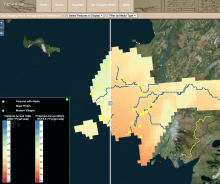
Since 2000, Calista Education and Culture (CEC) has worked with elders from the Alaskan communities of Kotlik, Emmonak, Alakanuk, Nunam Iqua, Newtok, Tununak, Toksook Bay, Nightmute, Chefornak, Kwigillingok, and Kongiganak to document Yup'ik place names.
This work was initiated and encouraged by CEC's Board of Elders as well as community members and funded by the National Science Foundation. Elders showed a strong desire to teach young people the rich history and named places of their homeland, including camp and settlement sites, rivers, sloughs, rocks, ponds, even sandbars and underwater channels.
During our work together community members shared more than 3,000 names as part of three ongoing CEC projects and two previous regional place name projects.
Fienup-Riordan, A. (2014). Yup'ik Environmental Knowledge Project, Version 1 [Data Set]. Compiled by M. John and A. Rearden. Boulder, Colorado USA. National Snow and Ice Data Center. https://doi.org/10.7265/N52R3PNT

