By Agnieszka Gautier
When Yup’ik people from southwest Alaska travel on their ancestral lands and waters, they navigate using traditional place names. These geographical locations of camps or settlements, rivers, ponds, sloughs, even rocks and sandbars convey historical tales about ancestors or battles, or knowledge of harvesting areas and sacred places. Names such as Niugtayagaq, meaning small place of rustling noise, detail how people identify and relate to this land.
Before modern governance systems encouraged permanent settlements, Yup’ik people migrated seasonally across the landscape. Taking advantage of the rich marine life from the Bering Sea and the Yukon and Kuskokwim Rivers, the Yup’ik people dotted the coastlines with thousands of seasonal camps and settlements. In the 1960s, however, Yup’ik children were mandated to attend Alaskan schools, forcing Yup’ik families to settle into localized villages. Although they still migrate with the seasons, they return to these 56 established villages.
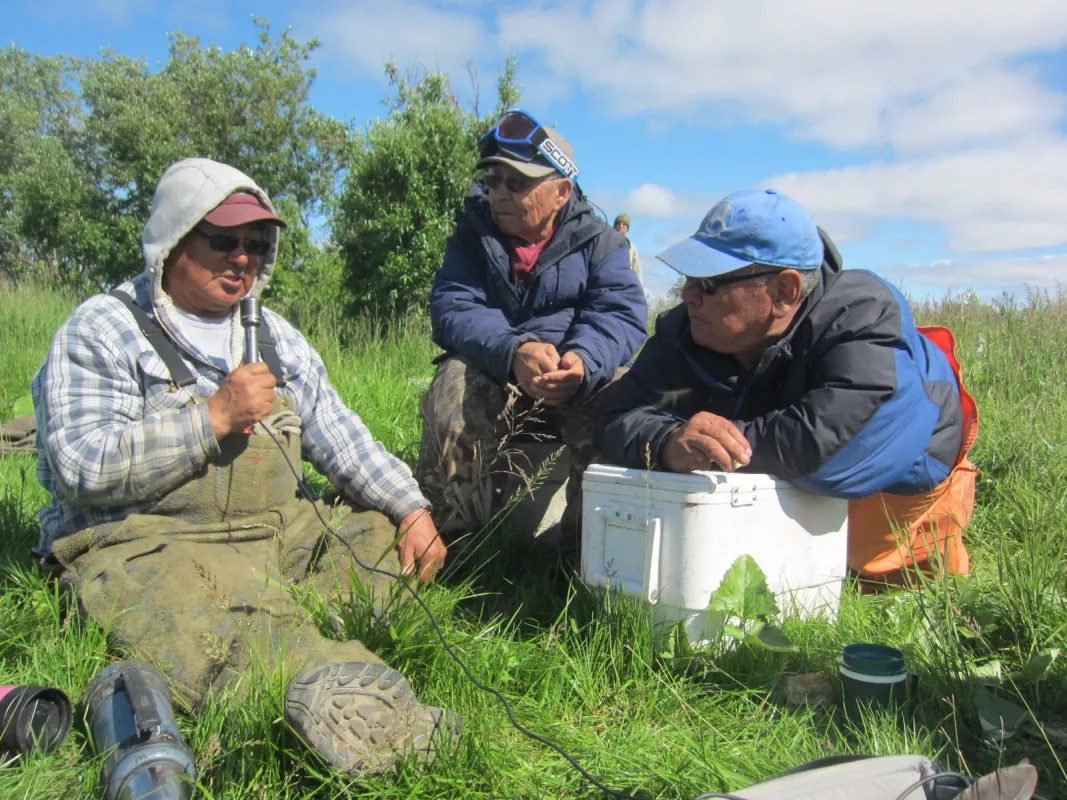
The thousands of sites left behind may appear as uninhabited and open land, but in fact are laden with traditions that the Yup’ik elders fear are being forgotten by their youth. As Elder Denis Sheldon of Alakanuk said, “Especially if our young people forget about the land and the names and the hunting places and those rivers, it’s like they will lose some of their body parts. But if they learn more about their identity, their minds will be stronger.”
To thwart the loss of knowledge, Yup’ik elders have been working with a non-profit organization, Calista Education and Culture, Inc. (CEC) and the Exchange of Local Observations and Knowledge of the Arctic (ELOKA), a NSIDC program, to immortalize their place names into an online atlas that continues to grow and evolve to this day.
Digital archive
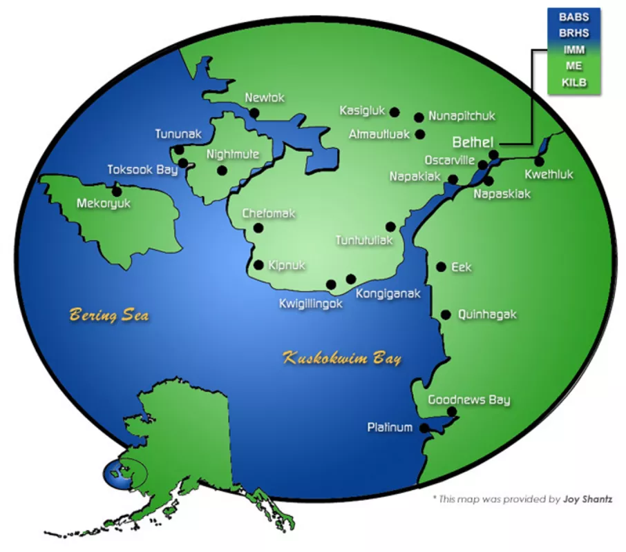
In 1997, Yup’ik elders began working with CEC, which represents 1,300 Yup'ik tradition bearers. In 2007, they began working with Nelson Island elders to document over 300 place names on the very large island near Bethel, Alaska, in the Bering Sea. Ann Riordan, a cultural anthropologist with CEC, met with ELOKA not long after to develop an interactive online atlas to document the place names. In 2012, the Yup’ik Atlas launched.
The Yup’ik Atlas holds over 4,000 place names with audio and visual files able to attach to each point. ELOKA customized the open source Nunalit software, the foundation of the Atlas, for the specific needs of CEC. “The cool part about the Nunalit software is that you can add infinite stuff to each point. It can grow hugely,” said Riordan. “But CEC does not have the staff to upload content, and we don’t feel like we should be putting it up on a community’s point.” That has been the goal all along: to give communities the tools to take the Atlas into their own hands and continue to grow it.
The tides began to turn in 2016 when the Lower Kuskokwim School District (LKSD) adopted a curriculum developed by CEC: Yuuyaraq, or the Yup’ik Way of Being. The program is an integral part of seventh, eighth, and ninth graders required course load, which focuses on a different aspect of Yup’ik culture for each grade. A nine-week course was developed for eighth graders to learn to talk about and document the place where they live. Riordan pushed for the Atlas to be part of this curriculum. “I told them if they didn’t include the Atlas in the Yuuyaraq curriculum, I would cry,” she said. “We want this to get used and the only way it would is if it’s required or funded in some way.”
Roll call
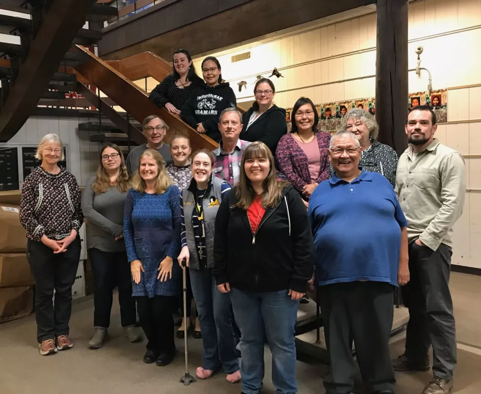
The LKSD spreads out over 22,000 miles of roadless tundra in southwest Alaska, servicing dozens of villages and Bethel, Alaska. By incorporating the curriculum into their school district, they are taking a step toward community control. To simply put a required stamp on the Atlas, however, is not enough to guaranteed its success. Therefore, ELOKA personnel have been working with participating teachers to teach them the Atlas’s functionality so they in turn can teach their students to upload content. ELOKA principal investigator Peter Pulsifer, data coordinator Chris McNeave, and research scientists Noor Johnson and Matthew Druckenmiller have all traveled to Bethel, Alaska, to deliver trainings to LKSD teachers and staff. McNeave has also supplemented in-person trainings with video conferencing and developed a library of training videos that can be streamed any time. Still, the personal connection remains integral. “People don’t just go to videos for training,” said Riordan. “They need a person.” McNeave and other ELOKA personnel provide ongoing support to teachers who implement the Atlas into their classrooms.
“We have been very grateful to ELOKA. It’s really been a gift and cool project,” Riordan said. Her hopes are that the Atlas continues to grow alongside the communities’ sense of ownership, bringing a sense of pride and accomplishment to the elders and school children who contribute. “The Atlas shows non-natives that this is not a wilderness, an unnamed, empty land, but a land that people have been using and knowing and working and living in for thousands of years; so the names make that point,” Riordan said. For instance, when developers make their way onto this land, the Yup’ik people can say these are historic sites and point to the Atlas as evidence. “It’s not just dead names that are not used anymore. It’s a living example of the vitality of the Yup’ik culture,” she said.
The students are populating the Atlas with content such as photos, which are mainly of people doing activities, either historic or contemporary. The Atlas also has archival videos of ritual dancing, current experiences of traveling on land, and general interviews on subsistence. In the story module, visitors can listen to an Elder speak about war and traditional stories in Yup’ik or they read the story in Yup’ik or English. The CEC is also adding an additional module focusing on climate change and local observations of those changes. “That’s in its future,” Riordan said. “We’ll see how that plays out and if people want to add to it, but that’s actually the direction we are taking it in.”
There are still challenges up ahead. Though people find the Atlas easy to use, securing follow up funding has been a challenge. Training someone to update the Atlas takes time and funds, not easily obtained. “People get excited about it, but things don’t happen ad lib,” said Riordan. “The ability to add to the Atlas will define whether it grows or does not grow. We’d like see communities take hold of this and take more ownership.” Like always though, through collaboration, connections, and communication, Riordan believes solutions will appear to help the Atlas thrive.


