Overview
Clyde River (Kangiqtugaapik) is located on the east coast of Baffin Island, Nunavut. Starting in 2009, local hunters and Elders partnered with researchers from the University of Colorado Boulder and Colorado State University to initiate the Silalirijiit Project.
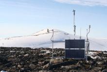
An Inuktitut word, silalirijiit (pronounced see-lah-LEE-ree-yeet) means "those who work with weather." This project facilitates collaboration and knowledge exchange between Inuit experts, visiting scientists, hunters, Elders, and youth. It braids Inuit Qaujimajatuqangit (IQ), environmental modeling, and a unique methodological approach that incorporates on-the-land teaching and learning. The project seeks to understand local and regional weather patterns and weather changes, and aims to identify weather and other environmental information that are of most importance and use to people in the Clyde River area.
This product was hosted by ELOKA from 2009 - 2023. It's now hosted by the Geomatics and Cartographic Research Centre (GCRC) at Carleton University in Ottawa, Canada.

