Environmental Knowledge
Environmental Knowledge
Cillaput: Our Weather, Yukon-Kuskokwim Delta Weather Station Network
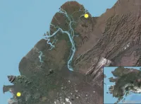
Cillaput: Our Weather provides access to current weather conditions in the villages of Chevak and Kotlik located in the Yukon-Kuskokwim Delta region of western Alaska. Measurements include air temperature, humidity, wind speed, snow depth, rainfall, solar radiation, and soil and surface temperatures. The weather stations were established in November 2017 and are running continuously.
Local Observations from the Seasonal Ice Zone Observing Network (SIZONet) and Alaska Arctic Observatory & Knowledge Hub (AAOKH)
This data set contains observations of sea ice, weather, and wildlife collected by Indigenous Inupiaq and Yup'ik sea ice experts in several communities along the northern and western coasts of Alaska, beginning in 2006. This information is generously shared with the public by the observers and the communities within which the observers reside.
Nunaput: Our Land, Community Atlas for Chevak, Alaska
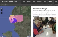
The Nunaput Atlas is a community-driven, interactive, online atlas for the Chevak (Alaska) Traditional Council and Chevak community members to create a record of observations, knowledge, and to share stories about their land. The Nunaput Atlas is being developed in collaboration with the community and the US Geological Survey.
PISUNA-net
Building from the development of the Alaska Arctic Observatory & Knowledge Hub (AAOKH) community observations platform, the PISUNA-Net observations database was developed to record, archive, and share Indigenous and local knowledge and expertise on natural resources and resource use on the western and northern coasts of Greenland. Observations begin in May 2009 through the present.
Yup'ik Environmental Knowledge Project Atlas
Since 2000, Calista Education and Culture (CEC) has worked with elders from the Alaskan communities of Kotlik, Emmonak, Alakanuk, Nunam Iqua, Newtok, Tununak, Toksook Bay, Nightmute, Chefornak, Kwigillingok, and Kongiganak to document Yup'ik place names.
Yup'ik Environmental Knowledge Project
Explore Yup'ik environmental knowledge of their land, named places, maps, language and values.
Since 2000, the Calista Elders Council (CEC) staff has worked with elders from Bering Sea coastal communities to document Yup'ik place names. Elders have been eager to teach young people their rich history and named places of their homeland, including camp and settlement sites, rivers, sloughs, rocks, ponds, even sandbars and underwater channels. More than 3,000 names have been identified with Yup'ik views on the importance of place names, the land, values, and language.
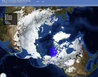
Atlas of Community-Based Monitoring in a Changing Arctic (Arctic CBM)
This atlas showcases Arctic communities actively involved in observing social and environmental change. It was designed to highlight the many community-based monitoring (CBM) and traditional knowledge (TK) initiatives across the circumpolar region.
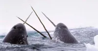
Baffin Bay Region Narwhal Tusk Research
Indigenous Foods Knowledges Network
The Indigenous Foods Knowledges Network is interested in ethically collecting, sharing, accessing, and visualizing data and documented Indigenous Knowledge to address food sovereignty. The core network members are Indigenous people, supported by researchers with a similar vision. They focus on two regions—the Arctic and the US Southwest—to broaden perspectives and build collaborations to offer personal experiences for food sovereignty in these regions.
Knowledge of the Caribou
The Knowledge of the Caribou database compiles Traditional and Local Ecological Knowledge (TLEK) observations of caribou from existing reports and documents recorded at caribou workshops and herd-specific working group meetings. These observations provide an important local record of the past and present state of the Arctic environment and caribou, but participation and knowledge sharing in these meetings represents a significant time burden on local community members.
Plants at the End of the World: Beringian Ethnobotany
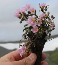
This site includes a visual catalog of Beringian plants accompanied by information about the traditional ways people in Western Alaska and Chukotka, Russia, use plants for food medicine and other purposes.
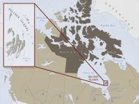
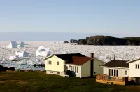
Sea Ice in the Belcher Islands, Nunavut, Canada
Snowchange Oral History - Work Among the Kolyma River Indigenous Societies in Siberia, Russia
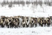
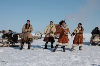
Geographic and environmental information from residents of two Indigenous Chukchi communities in the Republic of Sakha-Yakutia, Siberia, Russian Federation, practicing seasonal nomadic reindeer herding and other subsistence activities.
Summary Report of Community-Based Environmental and Species Observations from the Bering Sea Sub-Network
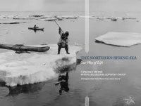
The Northern Bering Sea: Our Way of Life
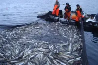
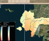
The purpose of The Northern Bering Sea: Our Way of Life is to show extensive areas where Alaska Native hunters and local fishermen harvest ocean resources, and the marine waters important to the resources we rely on. It illustrates that the whole northern Bering Sea is the storehouse that supports our way of life.
Voices from the Frontlines of a Changing Bering Sea
The Bering Sea is home to over 70 Indigenous communities of the Iñupiat, Central Yup’ik, Cup’ik, St. Lawrence Island Yupik, Unangan, and Chukchi Peoples. In recent years, the Bering Sea has experienced unprecedented declines in sea ice, threatening community food security, infrastructure, and travel. In winters 2018 and 2019, sea ice coverage was by far the lowest observed in at least the last 160 years.
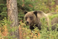
Waking the Bear: Understanding Circumpolar Bear Ceremonialism
Nunatsiavut Sea Ice Observer Program (NSIOP)
The Nunatsiavut Sea Ice Observer Program (NSIOP) generates detailed records of coastal environmental conditions based on the observations of Inuit knowledge holders in Nunatsiavut. The NSIOP supports a network of Inuit knowledge holders from all Nunatsiavut communities to make observations of the sea ice and other environmental and ecological conditions during the winter/spring sea ice season (approx. Dec-June) in their own words, from their own perspectives. The NSIOP has been collecting data since the 2021/22 season.
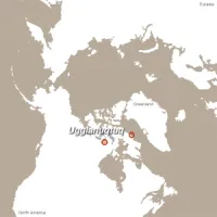
When the Weather is Uggianaqtuq: Inuit Observations of Environmental Change
In this interactive, multi-media CD-ROM, Inuit from two Inuit communities in Nunavut, Canada, share their observations and perspectives on recent environmental changes.
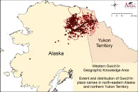
Gwich'in Place Names Atlas
Gwich’in Nąįį Googindì’ K’ìt / Gwich’in Place Names Atlas is a project that has developed an interactive, online Atlas of Gwich’in place names and stories. Working with Gwich’in communities and partners, ELOKA is developing the atlas so that knowledge of the land passed from generation to generation can be preserved and shared.
Topics: Traditional place names, including environmental features and settlements
Geographic areas: Yukon Territory, Alaska, and surrounding area.
